The Nunavut Land Claims Agreement
Date
1994-2003
Services & Technologies
CAD & Digital Modeling, Cadastral - Legal Land Surveying, Whitehorse, Whitehorse OfficeAbout This Project
The Claim
The Nunavut Land Claim involves the largest number of claimants and the largest geographic area of any land claim in Canada. There are approximately 19,000 Inuit in the Central and Eastern Northwest Territories. The Nunavut settlement area includes some 1.9 million km2 of the Northwest Territories (one-fifth of the total land mass of Canada). Inuit constitute over 80% of the population in the Nunavut Settlement Area.
In exchange for ceding, releasing and surrendering to Canada all of their Aboriginal claims, rights, title and interests, the Agreement provides the Inuit of Nunavut with (among other things):
- Title to 350,000km2 (136,000 sq. mi.) of land
- Joint management (with Canada) for land use, wildlife, environmental assessment, and water regulation wildlife harvesting rights
- Financial compensation of $580 million in 1989 dollars (amounts to $1.48 billion over payment period)
- A share of government royalties for oil, gas and mineral development on Crown Land[51]
In addition, the new Territory of Nunavut was created 1 April 1999.
The Survey
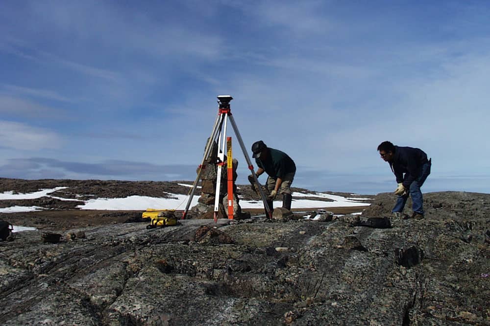
Given the size of the claim, Natural Resources Canada eliminated the need to run the rectilinear boundaries (as was done during the Inuvialuit Claim). Instead, the concept of an isolated boundary corner (IBC) was introduced. Since most of the corners were defined by either a height of land or an intersection with some natural feature (river, lake, ocean, etc.), only the ends and bends in the boundaries needed to be monumented. Given the lack of line posts, the IBC monuments were heavily referenced with a stone mound, carsonite marker posts and three CLS ’77 posts. Details of natural and cultural features within 200 metres of each corner were surveyed.
UGL was involved in 19 surveys of this claim from 1994 to 2003, comprising over 2,700 isolated boundary corners. On four of the surveys, Underhill worked with Usher Canada Limited and Marshall Macklin Monaghan.
All surveys were done in conjunction with the Kitikmeot Corporation, an organization responsible for the promotion of economic development in the Kitikmeot Region of Nunavut. Nunavut businesses were used exclusively for all project support (including Nunasi Helicopters). Field crews generally included a Canada Land Surveyor from Underhill, supported by two Inuit assistants.
Twenty-four hours of daylight above the Arctic Circle in the summer months made it feasible to run two 10-hour shifts each day with one helicopter and two pilots. Between shifts, the helicopter engineer performed maintenance, while the crews swapped out GPS receiver memory cards and batteries and loaded up posts for the next shift. A full-time GPS processor and CAD draftsperson was needed on site to keep up with the volume of work. In this way, two crews could monument and survey about 10 corners a day (the record was 20). All data were reduced and adjusted in the field so that all issues were resolved in the field prior to demobilization.


